Uganda

Rwenzori Mountains

When to visit
January to February and June to July
Size
996 sq km
Temperature
24 'C
Rainfall
70mm
Age requirement
12 Year

Overview

About Rwenzori Mountains

The Rwenzori Mountains rise along Uganda’s border with the Democratic Republic of Congo, a range of glaciated peaks that Ptolemy described in the second century as the Mountains of the Moon and named as a source of the Nile.

Margherita Peak on Mount Stanley reaches 5,109 metres, making it the third highest point in Africa after Kilimanjaro and Mount Kenya. Unlike either, the Rwenzoris are a genuine mountain range rather than a single volcano, with six main massifs separated by deep glacial valleys.

What sets the range apart is its vegetation. Above the montane forest lies a belt of Afro-alpine moorland where giant lobelia and groundsel grow to several metres, mosses drape everything, and the whole landscape has an appearance visitors consistently describe as otherworldly.

Rwenzori Mountains National Park covers 996 square kilometres and was inscribed as a UNESCO World Heritage Site in 1994. The glaciers have retreated dramatically over the past century and are expected to disappear within decades.
People and culture

People and culture

The Bakonzo live on the lower slopes on the Ugandan side and the Banande on the Congolese, and both regard the range as sacred. Kitasamba, the god of the mountains, is central to Bakonzo belief, and certain areas carry restrictions that guides will explain.

Almost all guides, porters and cooks on the mountain are Bakonzo from the villages around Kasese and Kilembe, and trekking is one of the few substantial sources of cash employment in the region.

Two organisations run most trekking. Rwenzori Mountaineering Services operates the Central Circuit from Nyakalengija, and Rwenzori Trekking Services runs the Kilembe Trail from the south, and both are community-linked rather than externally owned.

The Duke of the Abruzzi led the first ascent of Margherita Peak in 1906, and his expedition mapped much of the range. The peaks carry names from that period alongside the older Bakonzo ones, which is worth knowing when reading a map.

Wildlife encounters

Wildlife encounters

The Rwenzoris are not a game-viewing destination, and visitors should arrive understanding that. The range is climbed for its landscape and its vegetation rather than for large mammals, which are scarce and rarely seen.

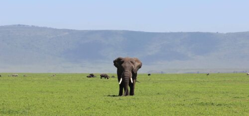
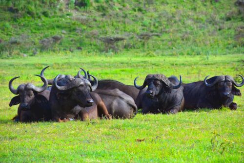
What the forest does hold is significant. Blue monkey, black-and-white colobus and L'Hoest's monkey occur in the montane belt, along with duiker, hyrax and giant forest hog. Forest elephant and buffalo are present in the lower forest but encounters are very rare, and chimpanzees occur in small numbers.

The Rwenzori three-horned chameleon, endemic to the range, is the species trekkers most often remember, found in the heath zone and pointed out by guides who know where to look.

Above the treeline mammals thin out almost entirely. What replaces them is the Afro-alpine flora: giant lobelia and groundsel several metres tall, everlasting flowers and moss-draped heather, a landscape with few parallels anywhere on earth.

Common wild animals

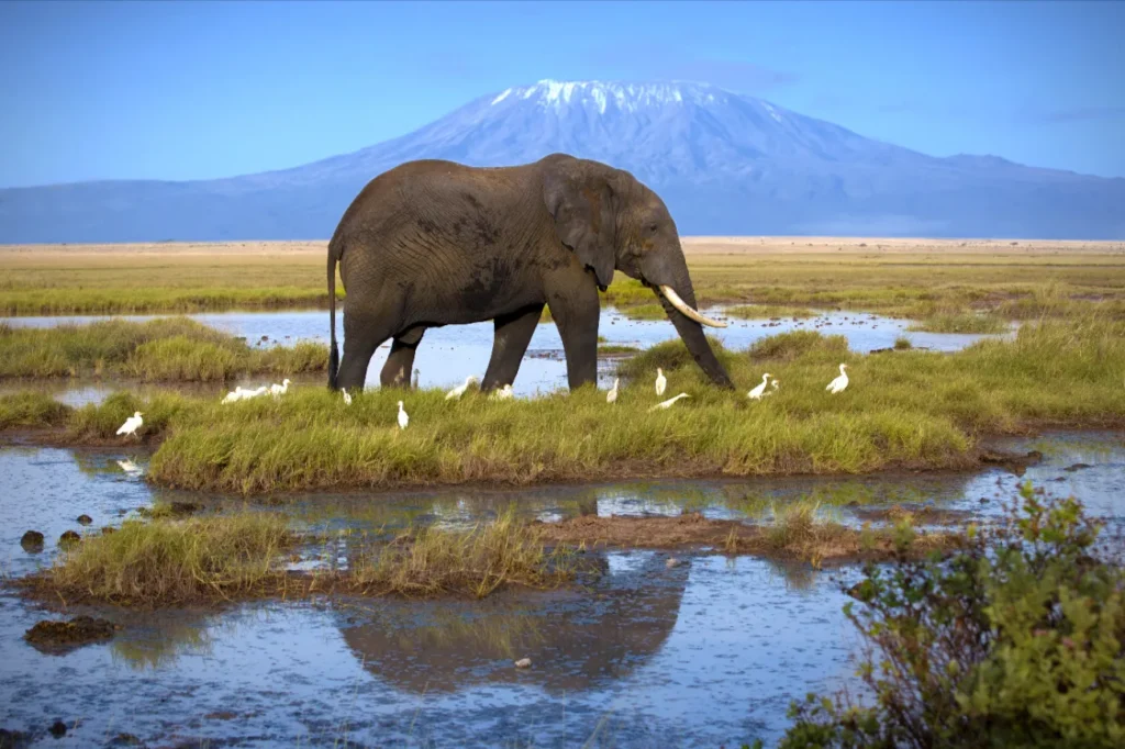
  • African Elephant

    Rare

  • African Buffalo

    Rare

  • Leopard

    Rare

Birdlife

Birdlife

Around 217 bird species have been recorded in the range, and while the total is modest the quality is exceptional, with 19 Albertine Rift endemics occurring here.

The Rwenzori turaco is the signature bird, a large green and crimson species found only in this chain and the neighbouring Congolese highlands, and it is heard far more often than it is seen in the montane forest.

Handsome francolin, Rwenzori batis, blue-headed sunbird, strange weaver, archer's robin-chat and Rwenzori nightjar are the other names birders come for, and most are confined to the forest belt below about 3,000 metres.

Birding is best on the lower stages of any trek, before the trail climbs into the heath and moorland where diversity falls away sharply. Guides on both main routes can usually identify the endemics by call.

Common bird species

  • African Grey Hornbills

    Occasional

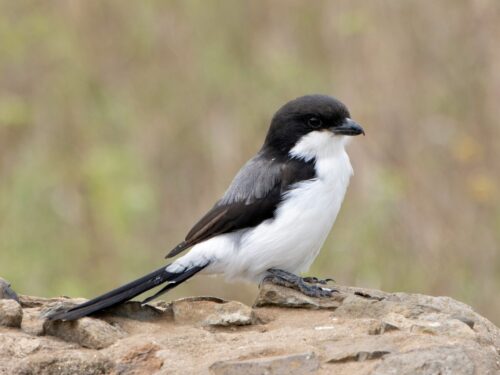
  • Common Fiscal

    Occasional

Getting there

How to get there

By Air

Light aircraft serve Kasese airstrip from Entebbe, taking around an hour and a half and removing a long day of driving at each end of a trek. Charter and scheduled options both operate depending on demand.

By Road

Kasese lies about 370 kilometres west of Kampala, six to seven hours by road on largely surfaced highway via Mbarara or Fort Portal. Buses run daily. The trailheads are within an hour of the town.

Trailheads

The Central Circuit starts at Nyakalengija, about 25 kilometres north of Kasese, and the Kilembe Trail starts at Kilembe roughly 12 kilometres west. Your operator determines which you use, so confirm the route before arranging transfers.

The range sits immediately north of Queen Elizabeth National Park, which makes the two straightforward to combine, and Fort Portal and the Kibale chimpanzee forest lie a couple of hours north.

Weather

Weather and climate in Rwenzori Mountains

The Rwenzoris are among the wettest mountains in Africa, and rain rather than temperature defines them. At the park gates around 1,600 metres days reach 24°C to 26°C and nights fall to around 14°C, but conditions change completely with height.

Month by month

High and low temperature and rainfall, shaded by how good the month is for a safari.

  • Jan

    25° / 14°

    80 mm

  • Feb

    26° / 14°

    90 mm

  • Mar

    25° / 14°

    180 mm

  • Apr

    24° / 14°

    240 mm

  • May

    24° / 14°

    200 mm

  • Jun

    24° / 13°

    90 mm

  • Jul

    24° / 13°

    70 mm

  • Aug

    24° / 13°

    110 mm

  • Sep

    25° / 14°

    180 mm

  • Oct

    24° / 14°

    230 mm

  • Nov

    24° / 14°

    220 mm

  • Dec

    25° / 14°

    130 mm

  • Excellent
  • Very good
  • Good
  • Fair
  • Avoid

Above 4,000 metres nights drop well below freezing, and the summit area of Mount Stanley holds permanent ice, though the glaciers have retreated dramatically and now cover a fraction of their extent a century ago.

Rain falls in every month. The heaviest periods run from March to May and again from September to November, with annual rainfall on the western slopes exceeding 2,500 millimetres. Even the drier windows see regular afternoon cloud and precipitation.

The practical consequence is mud, and a great deal of it. The bogs on the Central Circuit are notorious, waist-deep in places after heavy rain, and full waterproofs, gaiters and boots that can be soaked repeatedly are essential in any season. Nothing dries once you are on the mountain, so pack spare layers in dry bags.

Best time to go

Best time to visit Rwenzori Mountains

Best months
Jan–Feb, Jun–Aug, Dec

The Rwenzoris can be trekked year-round, but the difference between the wet and drier windows is substantial, and it is measured in mud rather than in rainfall totals.

December to February is the driest and most reliable window, with firmer ground underfoot, better visibility of the peaks and a considerably higher chance of clear conditions on summit day. It is the period most operators recommend.

June to August is the second drier window and works well, with July generally the driest single month of the year. Conditions are still wet by any normal standard, but the bogs are more manageable.

March to May and September to November bring the heaviest rain, when the bogs become genuinely punishing and cloud sits on the range for days at a time. Trekking continues through these months but the effort involved rises sharply.

Whichever window you choose, expect rain. This is not a mountain where a good forecast means dry feet, and the ability to be wet and cold for several days without losing morale matters more here than raw fitness does.

Safety

Safety and security

Altitude is the first consideration. Margherita Peak stands at 5,109 metres, and acute mountain sickness is a genuine risk on any itinerary that gains height quickly. Ascend slowly, drink constantly, and report headaches or nausea to your guide rather than pushing through them.

Hypothermia is the second, and on this range it is more likely than altitude sickness. You will be wet for days, temperatures on the upper mountain fall below freezing at night, and nothing dries. Waterproofs that genuinely work, spare layers in dry bags and a properly rated sleeping bag are essential rather than advisable.

The bogs and rock slabs cause most injuries. Footing is treacherous throughout, particularly on descent, and a walking pole makes a real difference.

Margherita itself requires glacier travel with rope, crampons and ice axe. Do not attempt it without a guide equipped and trained for it. Evacuation from the high camps is slow and on foot, so insurance covering trekking above 4,000 metres and helicopter evacuation matters here more than on most mountains.

Health precautions

Uganda requires proof of yellow fever vaccination on entry, and it is checked. Consult a travel clinic six to eight weeks before departure about typhoid, hepatitis A and B and tetanus alongside it.

Malaria is present in the lowlands around Kasese though the risk falls away with altitude, so prophylaxis is advised for the approach and the days either side of a trek rather than for the mountain itself.

Fitness matters more here than on most East African mountains. Days are long, the ground is saturated, and the effort of walking through deep bog is considerably greater than the distances suggest. Anyone attempting the Central Circuit should be comfortable with consecutive full days of demanding walking.

Facilities on the mountain are basic huts without heating, and the nearest hospital is at Kasese. Carry a personal first aid kit including blister treatment, and keep prescription medication in your daypack rather than in a porter's load.

Things to do

Things to do in Rwenzori Mountains

  1. Margherita Peak

    Mount Stanley

    Africa's third highest summit at 5,109 metres, requiring rope and crampons.

  2. Central Circuit Trek

    Nyakalengija

    The classic seven to nine day loop through the Bujuku and Mubuku valleys.

  3. Kilembe Trail

    Southern Approach

    A newer route from the south, generally drier and quieter underfoot.

  4. Afro-Alpine Moorland

    Upper Valleys

    Giant lobelia and groundsel several metres tall, found only at this altitude.

  5. Lake Bujuku

    Bujuku Valley

    A glacial lake beneath Mount Stanley, a high point of the Central Circuit.

  6. Rwenzori Turaco

    Montane Forest

    An Albertine Rift endemic, one of several found only in this range.

FAQ

Frequently asked questions

Do I need climbing experience for the Rwenzoris?

For the trekking routes through the valleys and moorland, no technical skill is required, though the terrain is demanding and often waterlogged. Reaching Margherita Peak on Mount Stanley is a different matter: it involves glacier travel, rope work and crampons, and requires either previous mountaineering experience or a guide equipped to lead you across the ice. Most trekkers stop short of the summit and still consider the trip worthwhile. Guides, porters and hut bookings are all arranged through the two operating companies rather than independently.

How long does a Rwenzori trek take?

The Central Circuit takes seven to nine days depending on whether you attempt Margherita Peak, and the Kilembe Trail offers routes from three to nine days. Shorter itineraries reach the moorland and the giant lobelia without going near the glaciers, which suits trekkers who want the landscape rather than the summit. Longer routes allow proper acclimatisation and considerably better odds on summit day. Kasese is the base town, and gear can be hired there if you would rather not carry full kit from home.

How bad is the mud really?

It is the defining feature of the range and the thing every returning trekker mentions. The bogs on the Central Circuit can be waist-deep after heavy rain, and even in the drier windows you will spend days walking through saturated ground. Gaiters, full waterproofs and boots you are prepared to have soaked throughout are essential rather than advisable. The range sits immediately north of Queen Elizabeth National Park, so the two combine naturally on a western Uganda trip.

When is the best time to trek?

December to February is the driest and most reliable window, with firmer ground, better visibility and the best chance of clear conditions on summit day. June to August is the second window, with July generally the driest month. March to May and September to November bring the heaviest rain, when the bogs become punishing and cloud sits on the range for days together. Rwenzori sees a tiny fraction of Kilimanjaro's traffic, so you are unlikely to meet another group on the trail.

Which route should I take?

The Central Circuit from Nyakalengija is the classic, a seven to nine day loop through the Bujuku and Mubuku valleys operated by Rwenzori Mountaineering Services. The Kilembe Trail approaches from the south, is run by Rwenzori Trekking Services, and is generally regarded as drier underfoot with better hut accommodation. Both reach the high moorland; both can be extended to Margherita. Guides, porters and hut bookings are all arranged through the two operating companies rather than independently.

How do I get to the Rwenzoris?

Kasese is the base town, about 370 kilometres west of Kampala and six to seven hours by road, and the trailheads at Nyakalengija and Kilembe are within an hour of it. Light aircraft serve Kasese airstrip from Entebbe, which removes a long drive. The range sits immediately north of Queen Elizabeth National Park, so the two combine naturally. Kasese is the base town, and gear can be hired there if you would rather not carry full kit from home.

Are the glaciers still there?

Yes, but barely, and they are retreating fast. Ice that covered several square kilometres a century ago has shrunk to isolated remnants on Stanley, Speke and Baker, and glaciologists expect them to disappear entirely within decades. Margherita Peak still requires crampons and rope, but the approach across the ice changes year to year as the glacier recedes. The range sits immediately north of Queen Elizabeth National Park, so the two combine naturally on a western Uganda trip.

How does it compare with Kilimanjaro?

Rwenzori is lower at 5,109 metres, far wetter, considerably harder underfoot and sees a tiny fraction of the traffic. Kilimanjaro's summit is reachable by walking; Margherita needs technical equipment. What the Rwenzoris offer instead is extraordinary Afro-alpine vegetation, genuine wilderness and near-solitude. Trekkers who have done both usually describe Rwenzori as the harder and the more memorable. Rwenzori sees a tiny fraction of Kilimanjaro's traffic, so you are unlikely to meet another group on the trail.

Explore other destinations

All destinations