
Tanzania

Mpanga Kipengere Game Reserve

When to visit
June to September
Size
1,574 sq km
Temperature
25 'C
Rainfall
15mm

Overview

About Mpanga Kipengere Game Reserve

Mpanga Kipengere Game Reserve lies in Tanzania’s Southern Highlands between the Kipengere Range and the Mpanga River, in Njombe region north of Lake Nyasa.

The reserve covers around 1,574 square kilometres of montane grassland, miombo woodland and river valley, spanning an altitude range from roughly 1,000 to 2,600 metres, which gives it an unusual variety of habitat for a single protected area.

Its principal ecological value is as a corridor. The reserve links the Kitulo Plateau with the wider Southern Highlands ecosystem, allowing movement between fragmented blocks of montane habitat that would otherwise be isolated by farmland.

It receives almost no tourism, has minimal infrastructure and is visited mainly by researchers and by the occasional well-equipped traveller working through this quiet corner of the country. Its ecological importance is far better documented than its visitor potential.
People and culture

People and culture

The Bena and Kinga peoples farm the highlands around the reserve, growing maize, potatoes and increasingly tea on the cool volcanic soils that make Njombe region agriculturally distinct from most of Tanzania.

The farming calendar here is quite unlike the rest of the country, with temperate crops, pyrethrum and timber plantations alongside the usual staples. Njombe has become a significant centre for avocado and tea production in recent years.

Njombe town is the regional centre and the practical base for any visit, with the guiding, supplies and fuel that the reserve itself entirely lacks. It sits at around 1,900 metres and has one of the coolest climates of any town in Tanzania.

The Kinga in particular have a long association with the Kipengere Range, and their settlements on the higher ground represent some of the highest permanent agriculture in the country. Local knowledge of routes through the reserve rests almost entirely with these communities.

Getting there

How to get there

By Road

The reserve is reached from Njombe, itself about 700 kilometres from Dar es Salaam on the TANZAM highway via Iringa, or from Mbeya to the west. Access roads are unsealed and a 4×4 is essential.

Practicalities

There is no airstrip and no scheduled transport to the reserve. Supplies, fuel and any guiding arrangements should be organised in Njombe or Mbeya before setting out, as nothing is available on site.

Weather

Weather and climate in Mpanga Kipengere Game Reserve

Mpanga Kipengere sits high, between roughly 1,000 and 2,600 metres across the Kipengere Range, and its climate is among the coolest in Tanzania. Days run between 25°C and 29°C at lower elevations, but nights on the higher grassland regularly fall to 9°C or below in June and July.

Month by month

High and low temperature and rainfall, shaded by how good the month is for a safari.

  • Jan

    26° / 15°

    190 mm

  • Feb

    26° / 15°

    170 mm

  • Mar

    26° / 15°

    180 mm

  • Apr

    26° / 14°

    110 mm

  • May

    26° / 12°

    25 mm

  • Jun

    25° / 10°

    5 mm

  • Jul

    25° / 9°

    3 mm

  • Aug

    27° / 10°

    3 mm

  • Sep

    29° / 12°

    10 mm

  • Oct

    29° / 14°

    50 mm

  • Nov

    28° / 15°

    140 mm

  • Dec

    26° / 15°

    180 mm

  • Excellent
  • Very good
  • Good
  • Fair
  • Avoid

The wet season runs from November through April and is heavy, with annual rainfall well over 1,000 millimetres on the higher ground. During these months the montane grassland is green and flowering, echoing the display on the neighbouring Kitulo Plateau.

The dry season from May to October is clear, cold at night and much the easier period for travel. August and September are warm by day, dry and stable, and the long views across the Southern Highlands open up once the cloud lifts.

This is not a tropical lowland reserve and should not be packed for as one. Frost has been recorded on the highest grassland, which is unusual anywhere in Tanzania.

Cloud and mist can drop visibility on the open grassland to a few metres within minutes, and there is no marked path.

Best time to go

Best time to visit Mpanga Kipengere Game Reserve

Best months
May–Oct

Mpanga Kipengere is a dry-season destination, and given the state of the access roads that is less a preference than a requirement.

June to October is the practical window. Roads are passable, river crossings manageable, and the montane grassland opens into long views across the Kipengere Range. Nights are genuinely cold through June and July, so proper equipment matters.

August and September offer the best combination within that window, warm by day and dry and stable, with the clearest visibility of the year.

November to April brings heavy sustained rain. The highlands are strikingly green and the grassland flowers, which for a botanist is a genuine draw, but the unsealed roads deteriorate badly and there is no infrastructure to fall back on.

Whichever season you choose, arrange guiding and supplies in Njombe or Mbeya beforehand.

Nothing at all is available at the reserve itself, so this is not a place to arrive unprepared and improvise. Allow considerably longer for journeys than the distances suggest, as the access tracks are slow even in good conditions.

Safety

Safety and security

Standard precautions apply. Travel with a licensed guide, keep valuables secured, and follow local advice on where and when it is sensible to walk. Roads deteriorate during the rains and night driving is best avoided throughout the region.

Where wildlife is present, remain in your vehicle outside designated areas and keep a respectful distance from all large animals. Water safety matters on the coast and the lakes: check conditions locally before swimming, and be aware of currents and tides.

Health precautions

Malaria is present across this region, so prophylaxis is advised and repellent should be used at dawn and dusk. Consult a travel clinic six to eight weeks before departure about yellow fever, typhoid, hepatitis A and B and tetanus.

Do not drink tap water untreated. Medical facilities vary considerably by location and are limited outside the larger towns, so travel with insurance that covers emergency evacuation and carry any prescription medication in your hand luggage.

Things to do

Things to do in Mpanga Kipengere Game Reserve

  1. Kipengere Range

    Montane Grassland

    High grassland and long views across the Southern Highlands.

  2. Mpanga River Valley

    Mpanga River

    Riverine woodland cutting through the miombo and grassland.

  3. Highland Birding

    Grassland · Woodland

    Montane species in an area almost never birded by visitors.

  4. Kitulo Plateau Link

    Northern Boundary

    The reserve forms a corridor toward the Kitulo flower plateau.

  5. Wilderness Camping

    Reserve Interior

    Self-sufficient camping with no facilities of any kind.

  6. Njombe Tea Country

    Surrounding Highlands

    Tea and pyrethrum farming on cool volcanic soils.

FAQ

Frequently asked questions

What is Mpanga Kipengere Game Reserve?

It is a protected area of around 1,574 square kilometres in Tanzania's Southern Highlands, lying between the Kipengere Range and the Mpanga River in Njombe region north of Lake Nyasa. The reserve covers montane grassland, miombo woodland and river valley, and functions as an ecological corridor linking the Kitulo Plateau with the wider Southern Highlands. It receives almost no tourism and is visited mainly by researchers rather than travellers.

Can I visit as an ordinary tourist?

You can, but it requires planning and a properly equipped vehicle. There is no airstrip, no scheduled transport, no lodges and no facilities of any kind within the reserve, so any visit means self-sufficient camping. Supplies, fuel and guiding must all be arranged in Njombe or Mbeya beforehand. It suits experienced, independent travellers rather than anyone expecting a serviced safari experience of any kind. Njombe is the practical base, with the guiding, fuel and supplies the reserve itself entirely lacks.

How cold does it get?

Considerably colder than most of Tanzania, which catches visitors out. The reserve spans roughly 1,000 to 2,600 metres, and on the higher grassland nights regularly drop to around 9°C or below during June and July. Days remain pleasant at 25°C to 29°C at lower elevations. Bring proper warm layers, a waterproof, and camping equipment rated for genuine cold rather than tropical conditions. Frost has been recorded on the highest ground.

When is the best time to go?

June to October is the practical window, when the unsealed access roads are passable, river crossings are manageable and the long views across the Kipengere Range open up. August and September offer the best combination of warm days and dry, stable conditions. From November to April the rain is heavy and sustained, roads deteriorate badly, and there is no infrastructure to fall back on if you get into difficulty. Allow considerably longer for journeys than distances suggest, as the access tracks are slow even in good conditions.

How do I get there?

The reserve is reached from Njombe, itself about 700 kilometres from Dar es Salaam on the TANZAM highway via Iringa, or from Mbeya to the west. Access roads are unsealed and a 4×4 is essential. There is no airstrip and no scheduled transport of any kind to the reserve. Allow considerably longer for journeys than the distances suggest, as the tracks are slow even in good conditions. Local knowledge of routes rests almost entirely with the Bena and Kinga communities farming the surrounding highlands.

What wildlife is there?

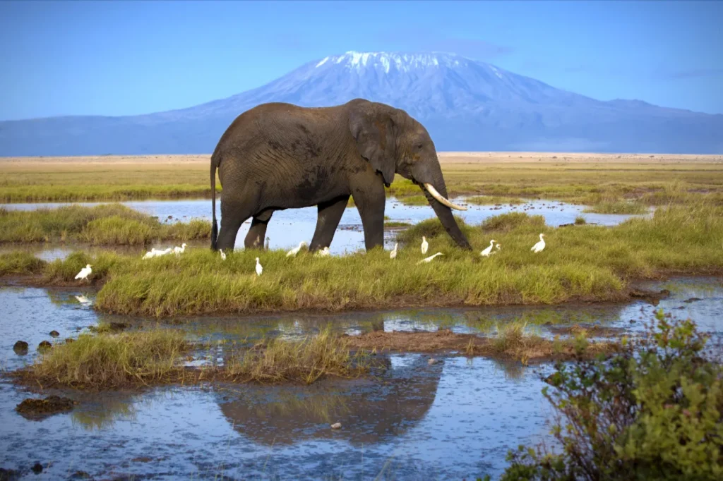
Buffalo occur in the woodland, with leopard and elephant present in small numbers, though sightings of any large mammal are uncommon and should not be the reason for a visit. The reserve's value is ecological rather than spectacular: it protects montane habitat and maintains connectivity for species moving between fragmented blocks. Highland birding is the more realistic draw, in an area almost never covered by visiting birders. Njombe is the practical base, with the guiding, fuel and supplies the reserve itself entirely lacks.

How does it relate to Kitulo Plateau?

The two are ecologically linked, with Mpanga Kipengere forming a corridor between the Kitulo Plateau and the wider Southern Highlands. They share montane grassland habitat and a flowering season, and the reserve's higher ground shows something of the same display that makes Kitulo famous, on a smaller scale. Visitors combining the two need a properly equipped vehicle and should base themselves in Mbeya or Njombe. Allow considerably longer for journeys than distances suggest, as the access tracks are slow even in good conditions.

Is it worth visiting?

Only for a specific kind of traveller. Anyone wanting wildlife spectacle will be disappointed, and the effort involved is considerable. For botanists, birders, and people who place real value on being somewhere genuinely unvisited in landscapes that see almost no outside traffic, it has a strong appeal. Treat it as an expedition into the Southern Highlands rather than as a conventional reserve visit. Local knowledge of routes rests almost entirely with the Bena and Kinga communities farming the surrounding highlands.

Explore other destinations

All destinations